 About us


AGIS
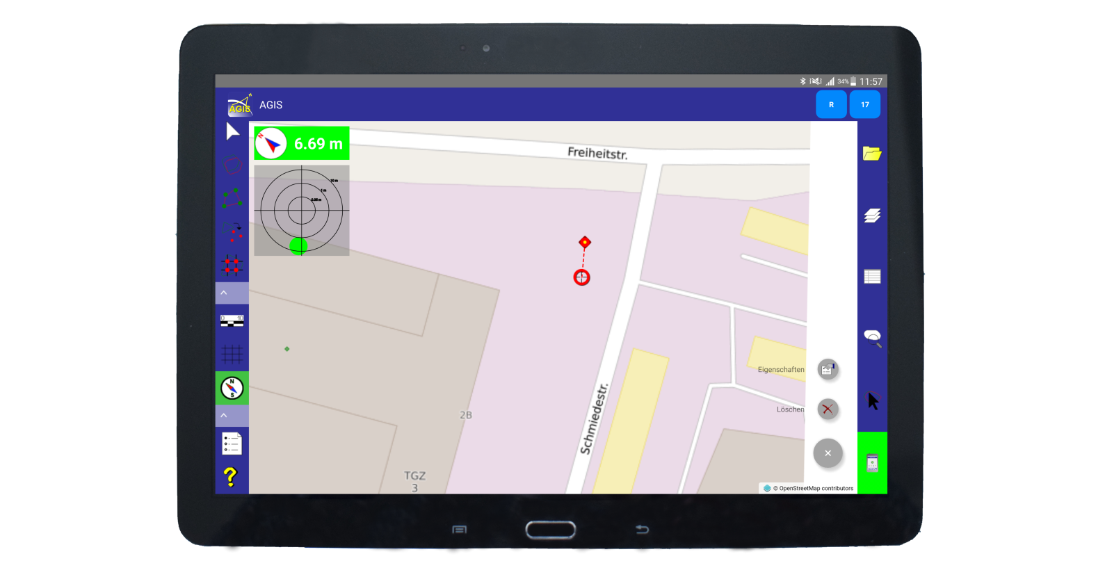
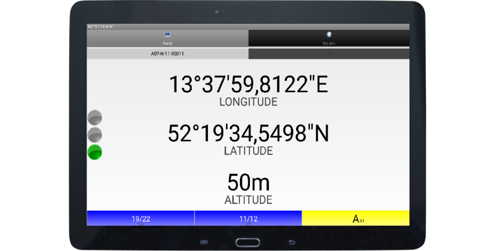
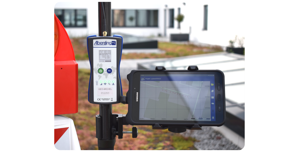
Alberding AGIS is a professional and intuitive software for GIS field data acquisition. The AGPS software is the interface connection between the Alberding A08-RTK GEO-MICHEL® sensors and the AGIS application. The AGPS and AGIS applications run on any Android operating system and can be installed on a Smartphone or Tablet PC.
AGPS
The AGPS software is used for wireless coupling between the A08-RTK sensor and the hardware for data acquisition. AGPS
provides the GNSS status information (received satellites, skyplot, accuracy information) and forwards this data to the
AGIS software.
AGIS
In addition to the project management structure, the AGIS software offers a variety of functions for geodata acquisition
and maintenance. These include recording vector data in the form of points, lines and polygons,
navigation to / staking out as well as editing of individual elements. Georeferenced photos can be taken for
documentation purposes. For field data management in a desktop GIS application, project data can be exported in
standard ESRI shapefile format.