 About us


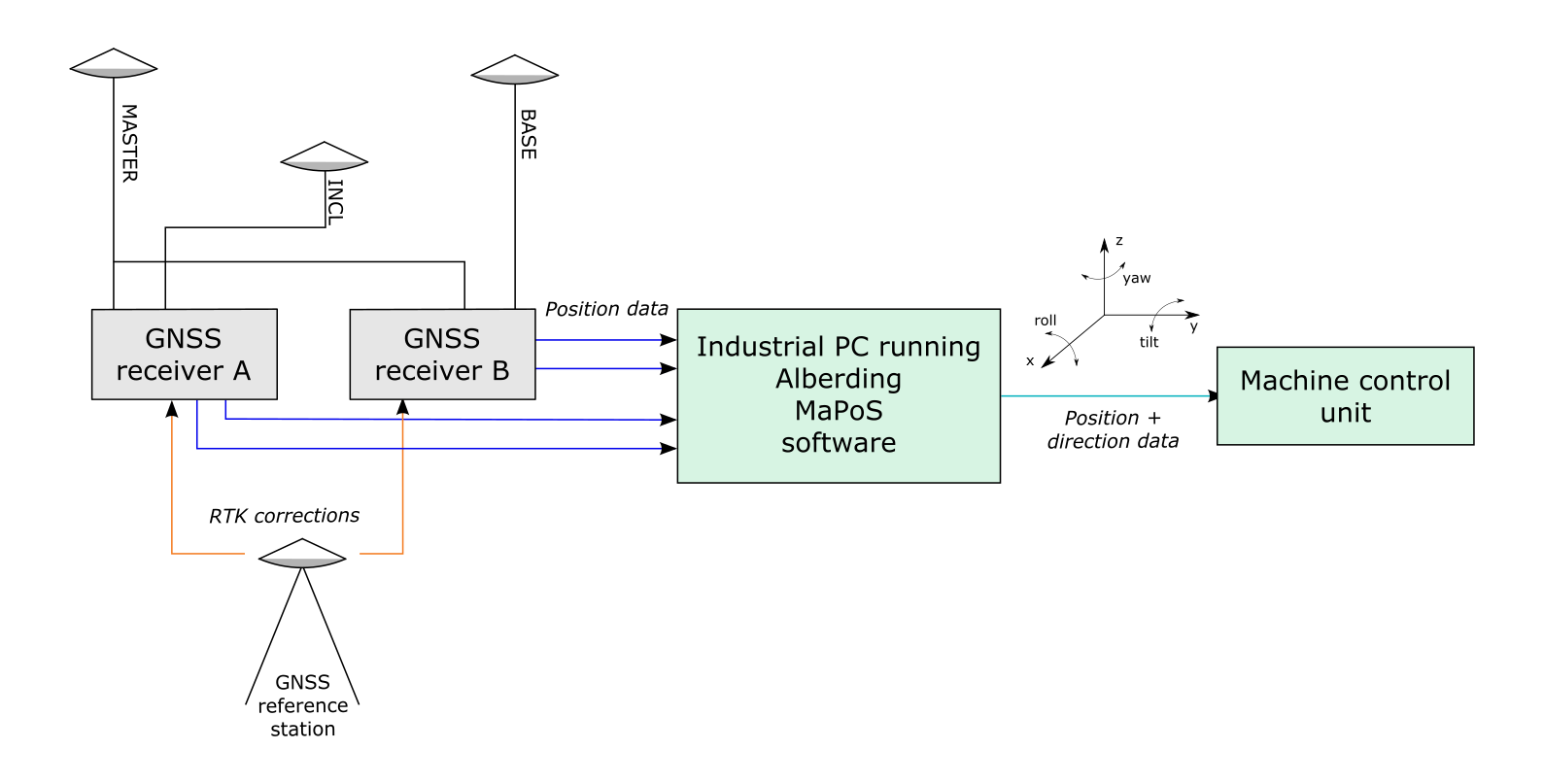
Machine positioning Software (MaPoS)
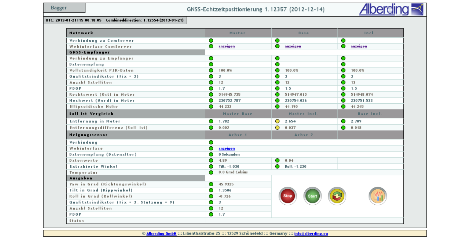
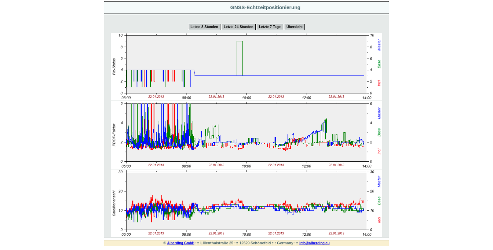
MaPoS has a web interface for position and direction monitoring. All important system parameters (e.g. receiver status, number of satellites, position quality, heading angle) are automatically monitored. If one of these parameters exceeds a predefined threshold value, visual warnings are generated.
Alberding MaPoS software supports a wide range of GNSS receiver types, real-time data formats and interfaces. Special adaptations and extensions of the software to customer requirements are possible.
Some selected features:
|